Click to view full screen
- Title:
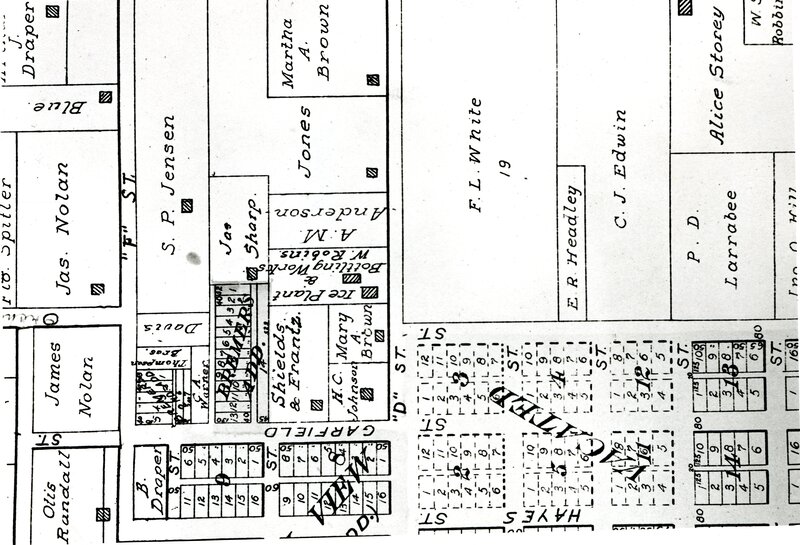
- Plat Map of Garfield, D Street, and F Street
- Sort Date:
- 1950
- Date Created Start:
- 1950
- Date Created End:
- 1960
- Description:
- A plat map showing D Street, F Street, Garfield and individuals that owned the homes and land.
- Subjects:
- D Street F Street Garfield Plat Map F.L. White C.J. Edwin
- Location:
- Moscow, Idaho
- Identifier:
- 01-04-026
- Type:
- Image;StillImage
- Format:
- image/jpeg
Do you know more about this item or have corrections to our information?
Please get in touch!
Contact LCHS
Source
- Preferred Citation:
- "Plat Map of Garfield, D Street, and F Street", 01-04-026, Latah County Historical Society, https://latahcountyhistoricalsociety.github.io/moscow-pilot/items/01-04-026.html
Rights
- Rights:
- Copyright, Latah County Historical Society Collections. All Rights reserved, contact the Latah County Historical Society for reproduction information.